
Dive type Reef
Dive site profile
SAS Pietermaritsburg
Cape Town, Western Cape, South AfricaAbout this dive site
Explore the water around Western Cape
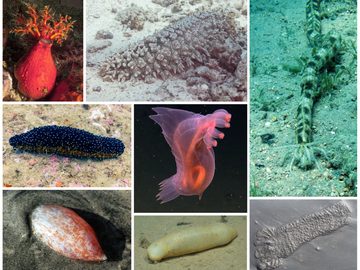
Name: The keel of this Algerine class ocean minesweeper was laid down on 8th October 1942 at Lobnitz and Co. Renfrewshire, the ship was launched on 18th June 1943 and completed on 7th October 1943. The ship was first commissioned in the Royal Navy as HMS Pelorus and took part in the D-day invasion of Normandy in the Second World War as the lead ship sweeping mines to make way for the invasion fleet. Sold in 1947 to the South African Navy the renamed "HMSAS Pietermaritzburg" was used as a training vessel and minesweeper. It was last decommissioned in July 1964, served as accommodations for the Mine Countermeasures squadron from 1968 to 1991 and was scuttled by explosive charges on 12 November 1994 to form an artificial reef. Specifications: Displacement loaded 1330 tonnes Length overall 68.6 m Beam 10.8 m Draft 3.5 m Indicated power 2400 Hp Depth: Maximum depth is 22 m on the sand to the stern. The sand at the bow is about a metre shallower, except in the scour pit, which is about 2 m deep at the forefoot. The deck at the bow is at about 17 m, and it slopes down gradually to the region of the wheelhouse, where the hull has fractured across the width of the vessel. The forward section is canted to port, and the midship section remains fairly level. The hull is also fractured at the break of the quarterdeck which is now almost as high as the midship section. The quarterdeck slopes down from 17 m at the high point to starboard at the break, down to about 19 m on the port side of the transom. The high point is at 16.5 m depth at the aft end of the superstructure. Marine life: The wreckage is heavily encrusted with invertebrates, and home to several species of fish. In September 2010 the dominant invertebrate species was clearly the Mauve sea cucumber, which is actually more a light grey in colour. The external surface of the wreck was covered almost everywhere with a carpet of these echinoderms. As of July 2011, there are far fewer cucumbers present, and many areas of the wreck are nearly bare. This may be a consequence of bad weather and structural collapse. Photography: This can be a good site for photography if the surge is moderate. Wide-angle and fisheye lenses will capture more of the mood of the wreck if the visibility is poor, which is often the case. There will also always be subjects for macro photography, but then you might as well dive on a reef. Topography: The wreck used to be upright on the flat shell-sand bottom. The ship lay almost level, embedded in the bottom as if floating in the sand. The bow is to the south, Longitudinal axis close to north/south True. The deep scouring at sides where holes let water surge through has largely filled in since the structural collapse of the hull and is now mostly around the bow. Water movement still prevents heavy silting and washes disturbed sediment clear fairly quickly.
Site details
Plan the dive
Dive Conditions
Dive Types
- Reef
What you may encounter
Marine Life
Dive site gallery
Photos from SAS Pietermaritsburg
No photos available.
Diver feedback
No reviews yet
Be the first diver to share a useful, honest account of this place.